In 2008, if you wanted high-resolution satellite imagery of a location, you had two options: request it from a government agency that had access to classified systems, or pay a large sum to one of a handful of commercial providers for imagery that was often days old. The technology existed. The access did not.
That has changed dramatically, and the change is still accelerating.
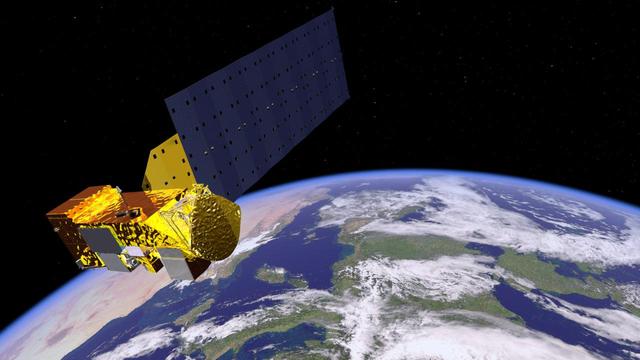
The Planet model
Planet Labs operates a constellation of over 200 smallsats capable of imaging every point on Earth’s land surface every day. The satellites are built cheaply, launched frequently, and replaced in small batches rather than as single expensive assets. When one generation of satellites ages out, a newer generation with improved sensors is already in orbit.
The daily cadence is the differentiator. Traditional commercial imagery providers could tell you what a place looked like on a specific day. Planet can tell you what changed between yesterday and today. That temporal resolution is what customers in agriculture, commodity tracking, environmental monitoring, and national security actually need.
New entrants and specialized capabilities
Planet focuses on optical imagery at medium resolution. The market around it has become populated with companies offering specialized capabilities. Capella Space and ICEYE provide synthetic aperture radar, which can image through clouds and at night. Satellogic offers very high resolution optical imagery at lower per-image cost than traditional providers. BlackSky builds a smaller constellation optimized for near-real-time revisit over specific target areas.
Each of these represents a capability that, a decade ago, existed only in classified government systems. The democratization is real and ongoing.
What this means
For journalists investigating environmental damage, for NGOs tracking troop movements in conflict zones, for hedge funds analyzing crop yields, for city planners and climate scientists, the availability of near-daily global imagery has changed what is possible. Information that required government-level resources to obtain can now be accessed through an API.
The implications for international security are also significant. State actors no longer have a monopoly on overhead surveillance. Every country, every large organization, and many smaller ones can now monitor what is happening on the surface of the Earth in near real time. That is a fundamental shift in the geopolitics of information.